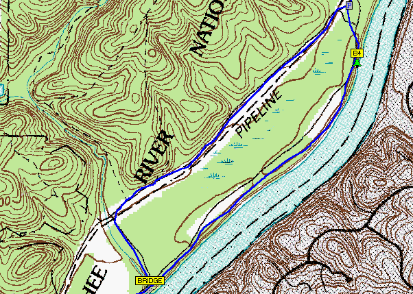
DRG stands for a digital raster graphic. It is simply a digital copy of a USGS topographical map. Th is map shows an river winding through some hilles. The minimum resolution on these types of maps is around 250 dots per inch.
Showing posts with label DRG. Show all posts
Showing posts with label DRG. Show all posts
Wednesday, October 1, 2008
#26 DRG
DRG stands for a digital raster graphic. It is simply a digital copy of a USGS topographical map. Th is map shows an river winding through some hilles. The minimum resolution on these types of maps is around 250 dots per inch.
Subscribe to:
Posts (Atom)